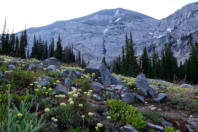
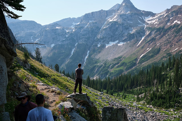
From July 17-24th I was away in Oregon for a long anticipated wilderness trek with the full complement of my backpacking buddies. Kyle, Jensen, Mike, and myself converged on Portland Oregon on the 17th and then made the 5-hour trek eastwards to Enterprise, which was to be our jumping off point for an adventure in the spectacular Eagle Cap Wilderness.
Below are some of my favourite images from the trip with a little bit of commentary. We had a fantastic time in some of the best alpine scenery we have come across. All told we covered around 100km, including day hikes.
 |
| Enterprise at Twilight |
Day 1 included a long, fairly gradual climb up from the Wallowa Trailhead to Frazier Lake.
First looks at Frazier Lake were a welcome sight after a solid day on the trail!
 |
| Camp 1 at Frazier Lake |
 |
| Mountain Chickadee |
Following our first night at Frazier Lake we started a steeper ascent up a beautiful valley to Glacier Lake.
 |
| entrance to Glacier Lake |
After a short but hot hike up to Glacier Lake, Mike and I immediately decided we needed a cool off. The frigid waters of Glacier Lake sufficed!
Mike and I had some energy left and so decided to try for an ascent of Glacier Peak, one of the two preeminent peaks that loom large over Glacier Lake. We threaded our way through the maze of boulders, cliffs, ridges, and other alpine lakes on the way up.
 |
| Prospect Lake, above Glacier Lake |
We soon encountered snow as we got above Prospect Lake.
After the snow came a bit of ridge scrambling along the very spine that rises to the summit to Glacier Peak. A few sketchy spots, but nothing too scary.
 |
| Don't slip! |
After some scrambling we reached the summit and were greated with spectacular views!
 |
| Glacier Lake on left, Prospect Lake on right. |
 |
| Yours truly on the summit of Glacier - Eagle Cap peak looms over my shoulder (we climbed that the next day) |
 |
| Mike and I on the summit - Prospect Lake is in the background. |

To head back down we noted a long, steep snow chute...we weighed the safety of going for a potentially uncontrolled slide for a few hundred feet and opted to go for it to avoid going down the most difficult sections of cliff scrambling. Mike went first, carrying a rock in each hand as a brake. The snow was fairly soft, making it possible for him to control his slide. I went next and foolishly went in his compacted path. I promptly lost both my stone hand brakes and was sliding uncontrolled towards the steepest section below Mike. Mike fortunately grabbed me before I went any further! I am sure I would have been fine, but didn't particularly want to find out haha.
We arrived back at camp some 4+hrs later after one of the finest day hikes I have ever done!
 |
| Camp at Glacier Peak |
For those interested, our track up and back from Glacier Peak added to Google Earth is below:

 |
| The summit. Note the red line on the right would be the snow slide, there was clearly more snow this year than when this imagery was taken! |
 |
| Morning reading and green tea! |
The following day the whole team decided to try for an ascent of Eagle Cap peak. There is a trail right to the summit on the more gradual north side of the mountain, but that would have taken us way too long to access, so we went for a more direct approach along the trail-less and steeper eastern face.
 |
| Part way up to Eagle Cap, looking southwest to Glacier Peak |
 |
| Glacier Lake from the feet of Eagle Cap |
Traversing snow fields as we approach the summit area.
 |
| Mike going for it while Jensen looks on. |
 |
| Jensen making his way across. |
There was one sketchy part before a more gradual walk to the summit (Kyle's bane).
 |
| Mike, Jensen, and I near the Eagle Cap summit. Glacier Peak in the background. |
Once again we utilized the snow fields to our advantage and saved lots of time heading down!
See the route of our ascent of Eagle Cap below:
 |
| The 4 mountaineers |
After 2 nights at Glacier Peak we took the trail down in elevation to the popular 'Lakes Basin', Despite being the busiest part of the park we saw almost no one and had Moccasin Lake all to ourselves!
 |
| We found a great spot in the river to bathe! |
The water of Moccasin Lake was cold, but more tolerable than Glacier and we all had some great swims here!
Kyle has momentarily forgotten how to open his bear barrel. How should we help him?
a) Righty loosey, b) lefty loosey, c) have two people both try to turn to the right simultaneously, d) smash on rock, or e) sink barrel in cold water?
 |
| Camp at Moccasin Lake |
 |
| Sunrise Moccasin Lake |
 |
| Sunrise Moccasion Lake |
The next day we headed further down the lakes basin to Horshoe Lake and were surprised to not see hardly anyone on the trail...we soon found out why as the smoke we had seen earlier became very thick, obscuring the mountains and views. It was starting to smell like a campfire, and so without knowing where the fire was, decided to head out that afternoon instead of the following morning.
 |
| There should be big mountains visible in that skyline! |
Arriving back in Enterprise after a long slog of 25+km, we promptly went and gorged ourselves on some restaurant dining. The view from Enterprise was very smokey (below is a photo of the same area in the first photo of this blog post).
We slept in Enterprise and then made the long drive back to Portland. We spent a half day exploring that strange but charming town before going our separate ways, confident that, God willing, we will one day all reunite on the trail of some other far flung wilderness area.


🚨🚨 YOU EVER GOT SCAMMED, THEN YOU SHOULD READ THIS 🚨🚨🚨
ReplyDeleteYou could probably get your money back, and I said probably, This is because most scammers don't move the money to a bank account, most scammers move it to a crypto currency wallet or a local money saving platforms, this way they stay undetected and noticed by authorities.
What you have to keep in mind is, this crypto wallet can be reported or hacked into, and this is what we do.
WHO ARE WE⁉️ YOU MIGHT ASK❗❕❗❕
We are ⭐PYTHONAX⭐ a group of skilled and experienced internet and computer experts. We have refocused our work force into tracking down scammers and helping victims of scam recover their money, or what's left of it. Using our experience in transactions tracking and jail breaking, we can now guarantee scam victims an opportunity to recover their money.
There are so many ways to get scammed in the world we live in today, majority of this scams are internet based scam, one of the major disadvantages of the internet. Here are examples of scams we have dealt with and can help such victims to this scams as well-:
❌Cryptocurrency investments scammed victims.
❌Forex/Binary Option investments scam victims.
❌Buying and Selling scam victims.
❌Dating & Romance scam victims.
❌Loans scams victims.
❌Housing & Estate Investments Scam victims. E.t.c.
How services are simple and and a breakdown of each steps of the process we will take to help you get your money back would be explained and told to you, what we do isn't illegal, we try and follow the rules and make sure you aren't involved in any crime. You can choose to remain anonymous, your personal info wouldn't be required of you, all we need are infos regarding the scam, infos like-:
1️⃣ Total Amount of what you were scammed.
2️⃣ The type of scam you were involved in.
3️⃣ The means of Communication you used in communicating with the scammers. Eg, emails, numbers or social media handles......
4️⃣ Details of which you used to make payments and transactions ID.
Do not feel shy or ashamed or stupid, this scammers are really good at what they do, they make everything look so real and convince and very very real like the actual real stuff.
Use this emails below to contact us-:
PYTHONAXHELP@PROTONMAIL.COM
PYTHONAXSERVICES@PROTONMAIL.COM
We assure you of no form of judgmets or guilt, we are professionals and only want to help