
For the past four years, my travelling friends and I have enjoyed an annual backpacking adventure. The first trip was to New Mexico's Gila Wilderness, the second and third were along the spine of the Rocky Mountains in Colorado and Montana, and in 2015, we shifted gears into the desert and canyonlands of Utah.
Mike, Jensen and I flew from Buffalo to Phoenix, Arizona where we picked up Kyle who flew in from Victoria, B.C. We drove our rental car 10 hrs north into Utah.
I didn't know that the Chevy Malibu was an off-road vehicle. But at midnight we were driving basically through the desert on what was supposed to be the access road to our trailhead in Utah's Escalante wilderness. I had planned this trip for months, but no matter how long I spend at the computer, in the guide books, or on the phone with staff, nothing can prepare me for actually being on site and things can and do go wrong. The two roads that I had heard were accessible without 4x4 were in horrendous condition with deep ruts, washouts, lots of sand and pointy rocks. This unknown X-factor is both the pain and the joy of these trips.
 |
| The daunting start of our trial to get to Early Weed Bench Trailhead |
After trying to get down several different access roads, we finally gave up at around 2am and slept for 3 hrs before heading in to the Escalante Visitor Center to get some advice on alternative routes or access points. We ultimately decided to try to access the same river area by a different road which was further, but in better condition. Tired but excited, we parked our car at the junction of Egypt Road and 25-Mile Wash and started hiking!
 |
| Smiling...for now. |

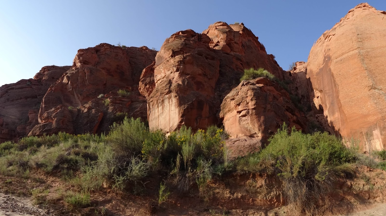
At first, walking was easy on the dry river bed of 25 Mile Wash. In this area, many of these river beds are dry for quite a while until a big thunderstorm pounds the area, water flows down ravines and builds into a torrent of water that sweeps the valley clean. In the process it has smoothed and shaped the red sand of the area into towering cliffs, arches, caves and other unique shapes unlike anywhere else I have seen.


 |
| Mike walking between the valley walls of 25 Mile Wash. |

I knew that water might be a problem for the first while, especially since we were starting further up the wash than I had previously planned due to our debacle on the access road. With temperatures near 100 degrees, we were quickly going through our water supply. We pressed on and eventually got our first signs of water.

Here we got our first taste of what I can only describe as quick sand. Muddy sand that looked solid on the surface but would give way into sticky slop the second it was stepped on. Our legs looked like this quite quickly. This made going very slow and our pace dropped to a crawl.

By late afternoon we were getting tired and a storm was starting to roll in. We took shelter up on this high "bench" surrounded by higher cliffs. Seeing debris wrapped 12 feet above the river bottom from the last flash flood made me leery or staying low during storms.
The storm didn't amount to much and we decided to climb up to the top of the cliffs to see what we could. We had already walked around 20km and were getting pretty tired.


I spotted this flat area on the other side of the river (centre of this photo) and thought it looked like a decent campsite. It turned out to be pretty good with an acceptable (albeit silty) water source trickling by. We decided to make camp here for the night.

We thought about our options and decided to stay at this camp for the next day and scout further ahead without our heavy packs in order to see if we could get much further given our slow progress.

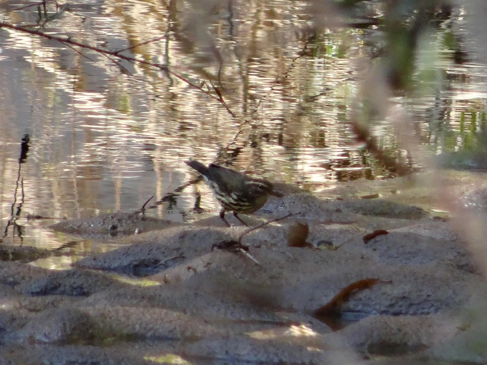 |
| Northern Waterthrush |
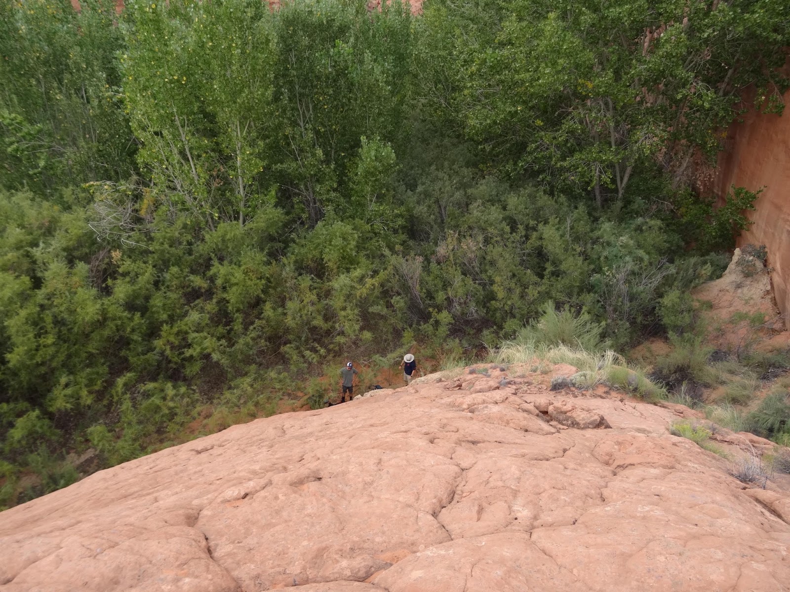
The below picture is a good example of just how high the flood water gets in these river bottoms. Look at all the debris wrapped around the trunks of these trees behind Mike and Jensen. We are sitting still about 5 feet above the main stream channel which is off to the left of this shot.

I saw several hummingbird species on this trip including Black-chinned, Rufous and the bird below which I think is a Broad-tailed Hummingbird based on the orange in the tail and the flanks, but hummingbirds are very tricky to ID and this one may require more work.


One nice treat on our day of scouting ahead was finding this tiny slot canyon that we squeezed into and explored. It was really neat but the mud was really deep and sticky!


We took frequent breaks in the shade of the cottonwoods to get sweet relief from the heat.

After hiking further down 25 Mile Wash we decided that we would not be able to get as far as we needed in order to complete our pre-determined loop, so we climbed up out of the canyon to the "roof" to see whether overland options were possible.

Cacti were plentiful in Escalante including this interesting pin cushion.


On top of the slick rock we saw many of these "Moqui Marbles" which I believe are formed by a process of wind and erosion.


 |
| Camp from above |

 |
| One of many different species of lizards we saw, yet to be ID'd |

Following our day of exploration down 25 Mile Wash, we made the decision to leave this area and try our luck in another canyon. This meant more wading and mucking around!


We made it out in good time after 3 days in 25 Mile Wash. We had a great time, but it was frustrating not being able to reach the area that I had planned to traverse. Part 2 of this trip report details our expedition into Coyote Gulch, AKA the desert death march and the cliff. Stay tuned!
This comment has been removed by a blog administrator.
ReplyDelete